Oregon Coast Bike Route
Trip dates: 2018 Aug 31 - Sept 9. See all photos here.
About a year ago, I saw the Oregon Coast Bike Route mentioned in a travel book, and I just knew I had to do it. Voitek joined, and we had a gang! With a little luck and a lot of duct tape, we cycled from Astoria all the way to Crescent City, traversing 458 miles with 20,000 feet of elevation gain over the course of a week. That's 737 km and 6100 meters for non-US readers.
(Note: The above numbers are based on Google Maps. The Strava distances below are over-estimates, because I didn't bother to pause the recording when we got off our bikes to explore or eat. You can see the more accurate numbers from Google Maps below each Strava widget.)
Day 0: Border Crossings
(From Astoria to Fort Stevens State Park. Data from Google Maps: 16.4 mi / 26.4 km with an elevation gain of 170 ft / 52 m.)
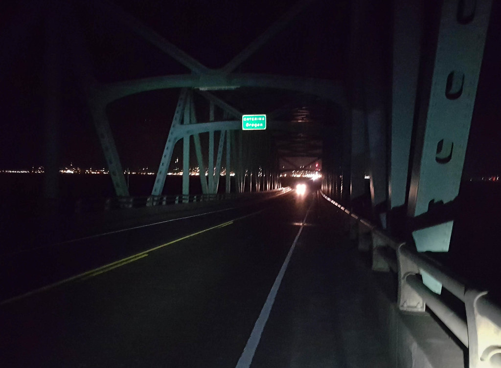
After twenty hours on a train and another three hours on a bus, we made it to our starting point of Astoria. We chose to travel this way because it didn't require us to disassemble our bikes. From there we rode over the bridge to Washington, just to claim the "Entering Oregon" sign.
Then we turned right back and biked to our campsite. It was already past 10 PM. For $8 per person per night, the hiker-biker campsites in Oregon state parks were pretty amazing. The bathroom taps had hot water, there were free hot showers, and they even had a fancy bike repair station and some lockers with USB charging slots, donated by REI.
Day 1: Duct Tape
(From Fort Stevens State Park to Nehalem Bay State Park. Data from Google Maps: 55.0 mi / 88.5 km with an elevation gain of 3,200 ft / 975 m.)
In the morning we explored Fort Stevens, where soft moss hung from the trees, a hundred-year-old shipwreck rusted on the beach, and fishermen staked out the mouth of the Columbia river.
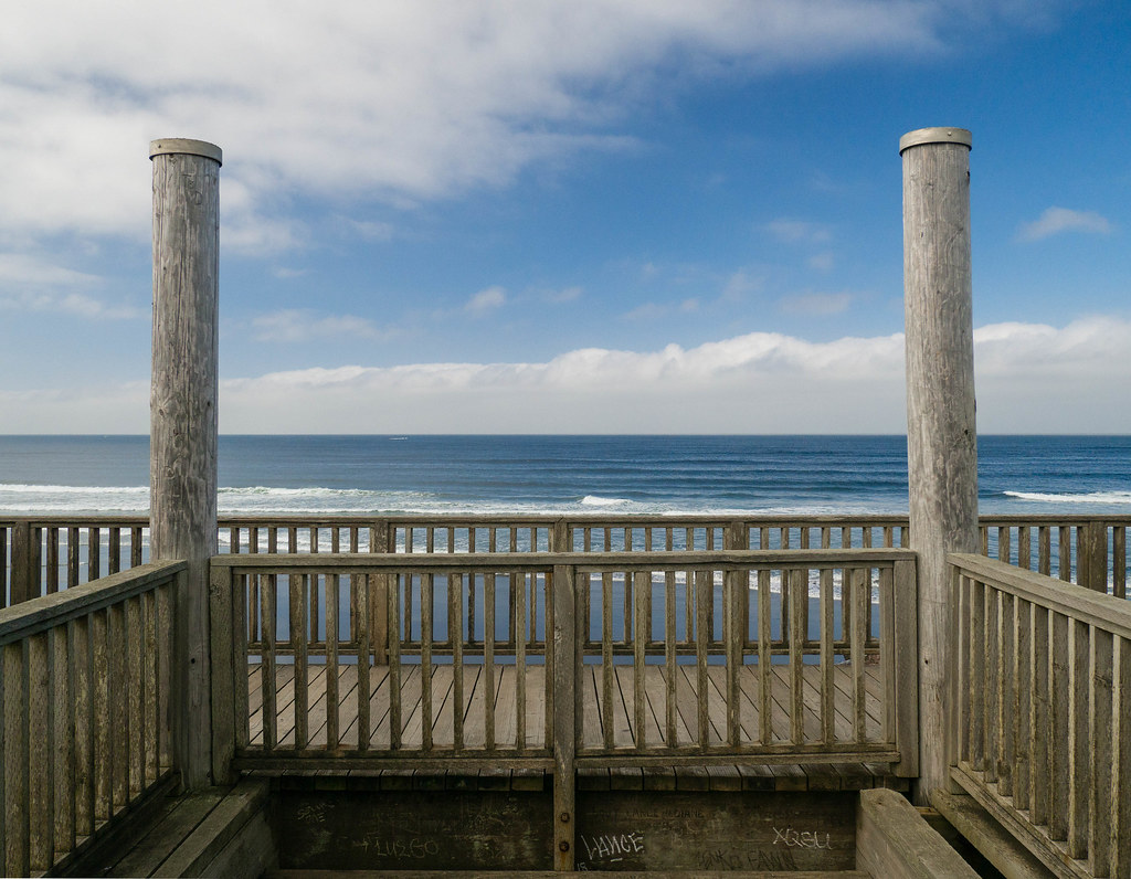
For lunch we stopped in Seaside, where we eyed the vacation homes built right on the beach. After that we took a detour to Ecola State Park, which involved some punishing climbs. At Indian Beach, Voitek went for a swim while I went for a short hike. Both endeavors ended in disappointment. I got stuck in mud up to my ankles, and didn't see any views because of the thick fog. Voitek learned that the water here was much colder than his CA wetsuit was designed for.
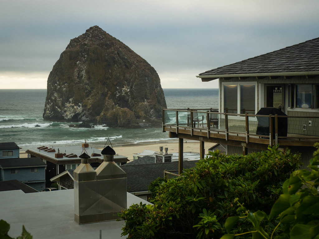
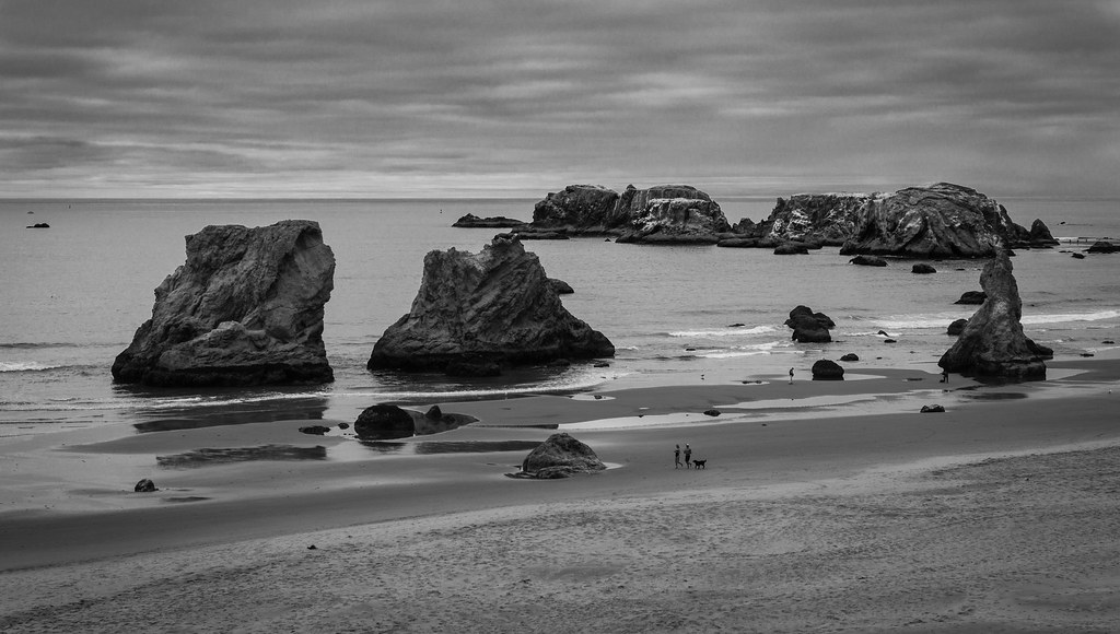
To regain some warmth, we got hot chocolate in Cannon Beach. Here Haystack Rock stuck out of the water like the head of a giant whale. Conscious of the few remaining daylight hours, we hurried south.
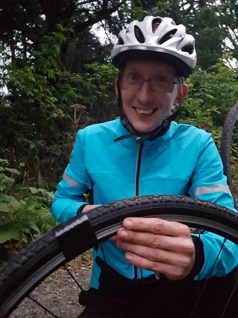
We wanted to catch the sunset from Oswald West State Park, but on the way there I got a flat. After quickly patching the tube, I noticed that the tire itself had a noticeable bump in that spot. This was very bad news, as it meant I would get more flats at best, and an exploded tire at worst. The next bike shop was 100 miles south. We decided to wrap the wounded section with duct tape and hope for the best. Voitek couldn't stop laughing at the crudeness of the fix.
We missed the sunset this way, but at least we ate a delicious Thai dinner in Manzanita. After getting some breakfast snacks and more duct tape, we biked to our campground for the night.
Day 2: Apples & Cheese
(From Nehalem Bay State Park to Cape Lookout State Park. Data from Google Maps: 49.3 mi / 79.3 km with an elevation gain of 2,200 ft / 673 m.)
The Miami Foley road was a gem. It led us through peaceful Oregon countryside, lush with greenery and away from the noise of the highway. We stopped to eat some apples from a tree on the side of the road. They tasted just like home. Later we saw some "giant mozzarella balls" in the fields, and wondered what they were. It turns out that even hay gets wrapped in plastic these days.
We stopped at the Tillamook Creamery for some free samples. The place was swarming with tourists. Heading west along the Three Capes loop, the wind almost knocked us off our bikes. We approached Cape Meares via highway 131, which proved formidably hilly. (Later we learned from other cyclists that Bayocean Road was quite passable, despite the "road closed" signs.)
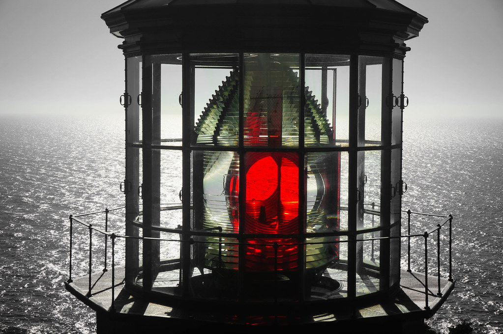
At Cape Meares we walked the short trail to an 800-year-old Sitka Spruce, the largest in Oregon. The earth around the tree was strangely pliable under our feet, as if hollow under a layer of roots. The Cape itself offered panoramic views of the coast, and a lighthouse with a Fresnel lens that we could see up close.
Biking south again, I got a flat in my front tire. Thankfully no duct tape was necessary this time. We stepped into a small grocery in Netarts around dusk. The shopkeeper was from Brooklyn, and we wondered what nightmares (real or imagined) brought him to a town of 744 on the other end of the continent. The only food place still open was a bar with elk skulls on the walls. As was becoming our habit, we rode the remaining six miles to the campground in the dark. The hot showers were glorious.
Day 3: A Mountain of Sand
(From Cape Lookout State Park to Beverly Beach State Park. Data from Google Maps: 61.4 mi / 98.8 km with an elevation gain of 3,040 ft / 926 m.)
Cape Lookout was blanketed in fog in the morning, so we skipped that hike. Near Sandlake we saw people riding dirt bikes on sand. We asked about renting some, but they only had ATVs. In Sitka Sedge we hiked along a marsh, through coastal forest, and onto a beautiful but desolate beach.
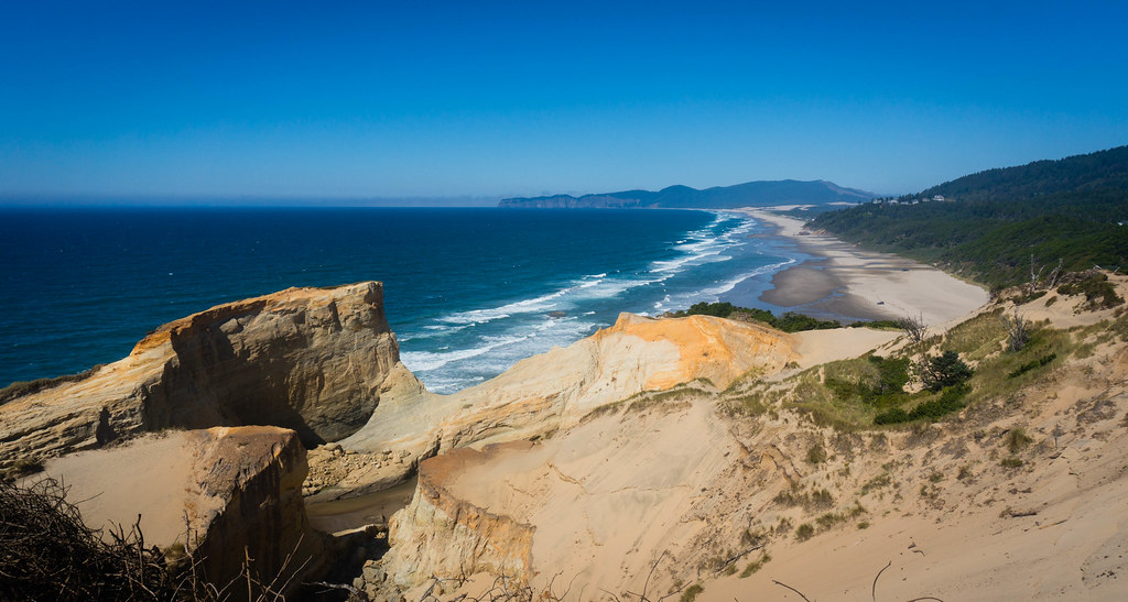
At Cape Kiwanda, the orange cliffs and white sand created a memorable landscape against the distant forest and the deep blue water. Strange stone formations offered gentle slopes on one side, and deadly drops on the other. Waves crashed against them, sending spray many meters into the air.
After a slow climb to the top, we ran down the surreal mountain of sand that formed the eastern end of the cape. We wished we had sleds. On the beach, a guy was neck-deep in sand, digging a hole with a shovel. Voitek asked him why, and he said he just started digging every morning, to see how far he would get. I suppose this is not that different from traversing 400 miles on a bicycle. I find such a trip immensely appealing, but I've struggled to explain this to some coworkers. Why not just drive?
By the time we were done with lunch (a disappointing faux-Asian place in Pacific City), it was almost 4 PM. We took Old Highway 101, a beautiful and nearly empty road through dense forest, which sometimes felt like a tunnel under the trees. After a long climb, we earned a sweet downhill that lasted a full ten minutes. In Lincoln City the duct tape finally failed, and I got another flat. I patched the tube and re-bandaged the tire, and we rolled on. By the side of an abandoned house, we saw two llamas that looked lost and confused.
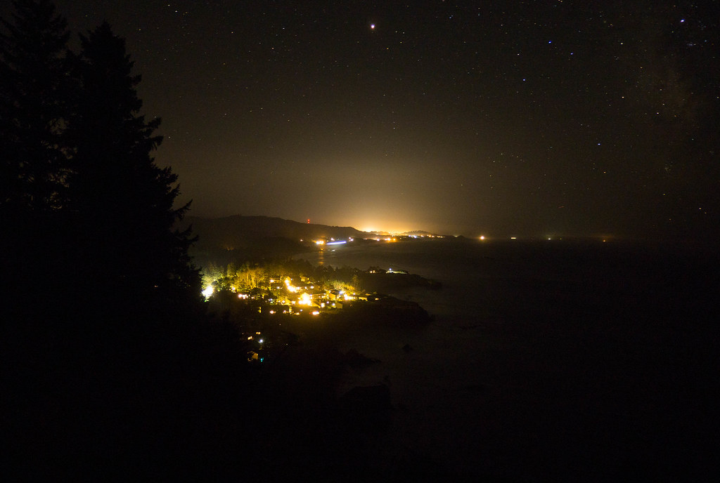
After some great burgers in Depoe Bay, we shivered as we got back out into the cold night air. The road was completely dark, illuminated only by the stars and our bike lights. We missed the ocean views on the remaining seven miles to Beverly Beach, but Voitek did score an awesome long-exposure photo.
Day 4: Rushing Nowhere
(From Beverly Beach State Park to Jessie M. Honeyman State Park. Data from Google Maps: 59.9 mi / 96.4 km with an elevation gain of 2,590 ft / 789 m.)
In Newport I finally got a new tire, Voitek shipped his wetsuit home to save some weight, and we ate an amazing breakfast of omelets and pancakes. This was followed by a few hours of monotonous riding on 101. Voitek used the time to listen to some Spanish podcasts, while I enjoyed that elusive empty-mind feeling that I get on long bike rides. We stopped at Cape Perpetua for some quick photos, but decided we didn't have time to explore.
We rushed to the Sea Lion Caves knowing they closed at 7 PM. Unfortunately, the closed sign was already hanging when we got there at 6. We continued to Florence, rolling our eyes at the name. There were some sand dunes next to a supermarket, so of course we took our shoes off and went for a walk. Later, Voitek found an amazing Thai place for dinner. He then promptly started chatting up one of their female employees, in Thai no less.
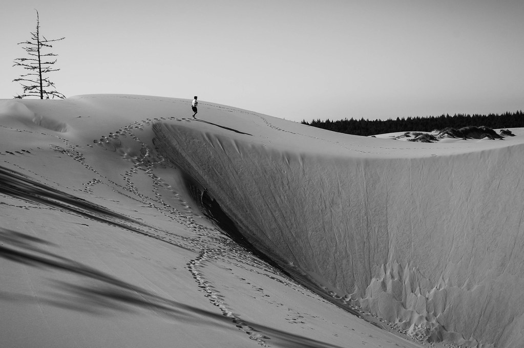
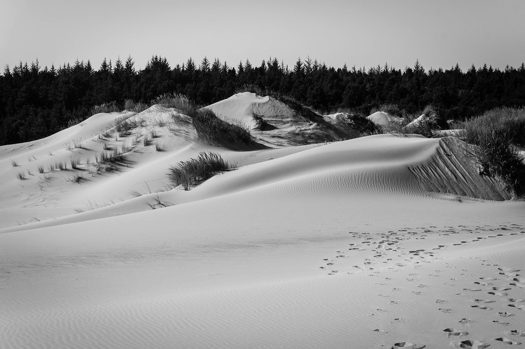
Day 5: Dunes!
(From Jessie M. Honeyman State Park to Sunset Bay State Park. Data from Google Maps: 57.2 mi / 92.0 km with an elevation gain of 1,940 ft / 592 m.)
We started our day with a few hours of biking, and stopped for lunch at a sourdough bakery in Winchester Bay). Shortly after that we arrived at the John Dellenback trailhead, our chosen starting point for exploring the Oregon Dunes. We were not disappointed.
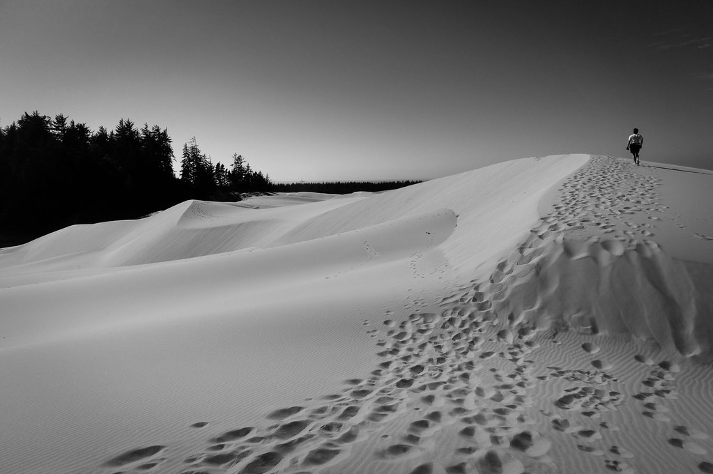
The landscape was unlike anything I'd seen before. At the macro level the dunes seemed to stretch for miles and miles, dwarfing the few human figures ambling along the ridges. At the micro level the terrain had a washboard pattern that yielded easily to our feet in some places, and provided a surprising amount of resistance in others. We had some fun bombing down the steepest edges we could find, and observing the sand erase our tracks in a miniature avalanche.
The smooth gradients of the rolling dunes were interrupted here and there by patches of beachgrass and other defiant species. We also saw some undulating tracks that looked like they were made by snakes. A thick layer of forest lay between us and the ocean.
As we walked west, the landscape turned into a marsh, and the trail turned into a boardwalk. The transition from sunny yellows to shady greens was startling. Soon the view opened up into an endless beach. A gang of snowy plovers hung out right next to a sign that said they were endangered.
After the dunes adventure, we biked south to Coos Bay. This was the largest town on our route (pop. 15,967), and the only one that gave us a sketchy vibe. The shoulderless bridge into North Bend was bathed in soft golden light around sunset, but we were too hungry to stop for photos. We ate a big dinner at an Italian place, then pedaled in the dark for another hour to get to our campsite.
Day 6: How Many Devils
(From Sunset Bay State Park to Humbug Mountain State Park. Data from Google Maps: 74.2 mi / 119.4 km with an elevation gain of 3,030 ft / 923 m.)
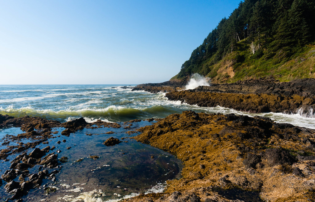
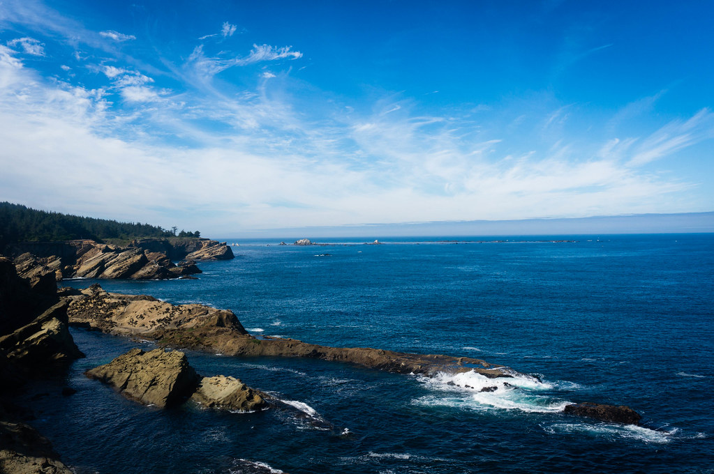
In the morning we explored Shore Acres State Park, which used to be some rich guy's private botanical garden. We also saw a whale lift its tail above the water, which made me miss my long-zoom camera. We stopped briefly at a sea lion viewpoint and at Cape Arago, but decided to get going since we had a long day ahead.
The way back to the highway was called Seven Devils Road. After the first two hills, it became apparent why. After another two, I stopped counting. At least there was no traffic to contend with. The view at the top was a modest reward: layers upon layers of forested hills, becoming bluer with the distance.
My bike had been sqeaking unhappily for the past few days, so the first thing we got in Bandon was chain lube. We then ate lunch and sampled the local beer. Shortly after that we passed through the dying town of Denmark, which was definitely no Florence.
Our final detour of the day was to Cape Blanco. The rocks along the shore made for some striking scenery, and we lingered to watch the sunset. On the trail back, we almost stepped on a porcupine.
We stopped for dinner at a bar in Port Orford. The building was a brand new construction in the log cabin style, surprisingly grandiose for a town of 1,133. The band had just left, but the burgers were excellent.
Day 7: Coastal Views
(From Humbug Mountain State Park to Harris Beach State Park. Google Maps data: 54.6 mi / 87.9 km with an elevation gain of 3,355 ft / 1022 m.)
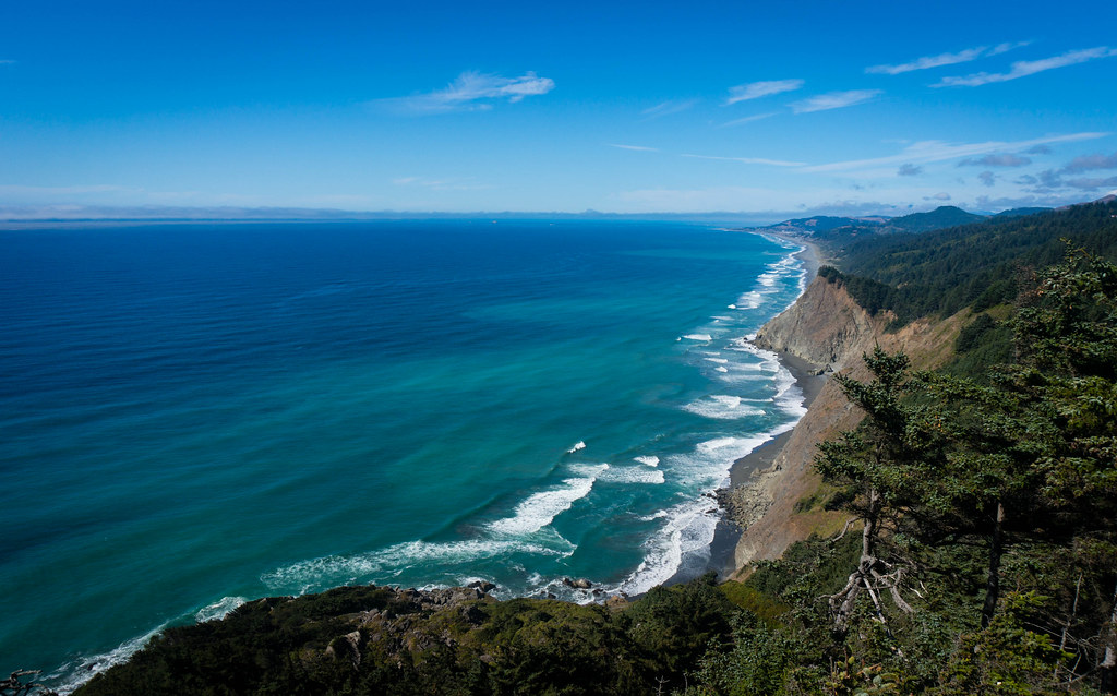
Our last full day was all about coastal views. They came at us from around every corner, much like on Highway 1 in California.
In Gold Beach we got some restaurant recommendations from a pair of tie-dyed RV-dwelling hippies. We ate a questionable American breakfast, while the restaurant owner took care of some business on the phone, cursing the other side colorfully as soon as she hung up. Later she gave us two pins to stick in the map on the wall. The US and Western Europe were thoroughly represented, but there was only one pin in Romania (hello Cluj-Napoca), and none in Moldova. Time to rectify that.
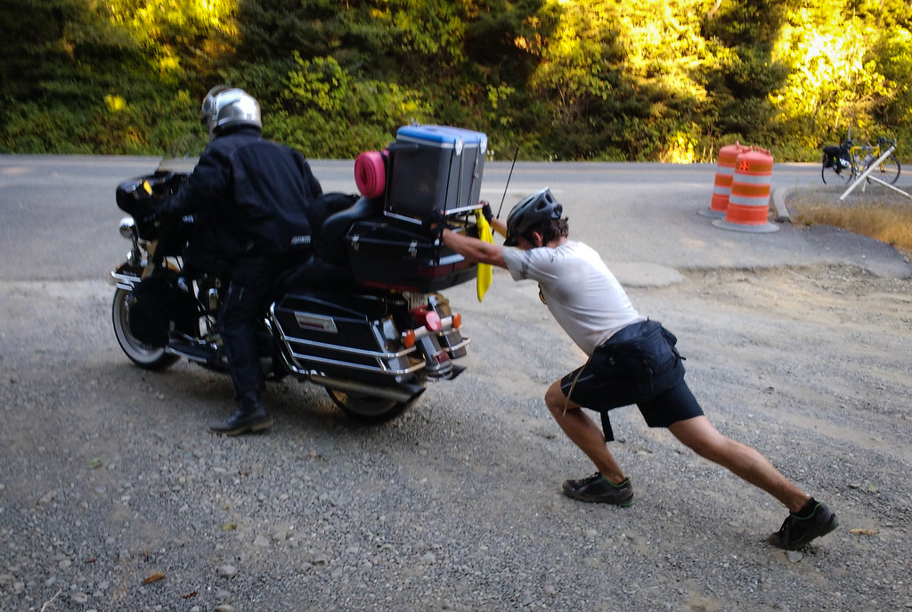
Later on, we found dessert in a bramble of blackberries growing in a turnout. In another turnout, we saw a guy on a motorcycle gesturing desperately at us. He needed a push, so we gave him one.
In Brookings we tried another one of the hippies' dubious recommendations: a Mexican restaurant in the shape of a converted gas station.
Day 8: Going Home
(From Harris Beach State Park to Crescent City, CA. Google Maps data: 29.6 mi / 47.6 km with an elevation gain of 510 ft / 155 m.)
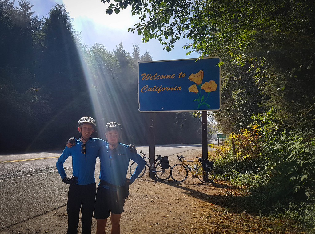
The trip was over in my mind as soon as we crossed the California border. I felt a bit of pride for having pulled this off, but overall, finishing the trip felt less exciting than being on the road and seeing new things every day. My mind immediately switched to worrying about the long drive home, and about going to work again the next day. Now that I'm back to zero vacation days, all I can do is to plan something even more ambitious for next year!
Final Thoughts
Overall, we were pretty lucky with no rain and no major bike issues. Here are some lessons we've learned from our first week-long bike tour:
-
Hell yes, we can do it!
-
State parks with hiker / biker campsites are amazing resources. For a list along the Oregon coast, check out this brochure. For a list in California, use the Find Parks page and select "Hike or Bike Campsites" under "Overnight Facilities".
-
Padded biking shorts and anti-chafe cream are miraculous. I used to do all my biking without them, and felt sore after about 50 miles. With them, I rode 50-60 miles for 7 days in a row, and felt like I could keep going even longer. I wonder why I never tried these things earlier.
-
Schedule a rest day. Biking 50-60 miles every day is doable, but having a shorter day in the middle would've made our knees happier.
-
Plan shorter days, or get disciplined and start earlier in the morning. Most other cyclists were gone by 7-8 AM, while we typically rolled out of camp around 10, and arrived at the next one after dark. I made a naive calculation before the trip: 13h of daylight - 6h of riding (60mi at 10mph) = 7h to rest, eat, and explore. In practice, a lot of this time was consumed by snoozing in the morning, breaking camp, or looking for the next place to eat.
-
Carry just enough food in case you bonk between stops, but no more. On this trip, we had access to restaurants and groceries every day. I carried too much: six energy bars and a big bag of trail mix, which was only half empty by the last day.
-
Do a fully-loaded overnight test ride close to home. The weekend before our big trip, we biked to Santa Cruz on Saturday, camped there, and biked back home on Sunday (about 45mi each way). This helped us debug any missing gear, and convince ourselves that our bikes and our legs were up to the task. I was pretty anxious about the big trip before, but after the test ride went well, my confidence went way up.
-
Get some new tires before the trip, and carry a lot of duct tape, just in case. ;-)
In true Mustachian fashion, here is an approximate breakdown of our expenses on this trip (all costs are per person):
- Getting from home to Astoria (Amtrak + bus): $159
- Biker campsites ($8 per night per person): $64
- Food (with all the riding, we ate 1.5x the normal amount): $230
- Bike things bought on the trip (new tire, chain lube, duct tape): $50
- Getting from Crescent City back home (one-way car rental + gas): $161
This comes down to $664 per person for an epic week-long adventure. The campsites are the most badass deal. Transportation could be optimized further, for example by having a friend pick us up (one-way car rentals are stupid expensive). The food could also be optimized, but we really enjoyed the luxury of eating out every day, and have no regrets about spending the money.